To :
Dreamer,
Let me share the
Music in a breeze of wind
Poems written in
the misty Mountains
Songs sung by the
trees in hilltops
The laughers of angels
I hear in waterfalls
The evenings painted
by Sun in the beaches
The worlds hidden
in the eyes of the living creatures
-
-
With You..
Let me show You what a beautiful world We live in.
Come.Let's Fly with Our Balloon House
From :
Another Dreamer named 'Gayan Rajapakshe'
Filmmaker | Photographer | Storyteller| Vlogger
In December 2022, we embarked on a trek to Dumbara, which we had been eagerly awaiting for some time. Our plan was to spend three nights in Dumbara, starting the trek from Lebanan estate in Bambarella, proceeding through Knuckles up to RKP (Rehena Ketu Pathana), and finally descending through the forest to end our trek in Meemure village.
A week before our trek, Sri Lanka experienced heavy rainfall, which resulted in the trail being rich with water resources all the way from Lebanan estate to Meemure. Despite RKP being known for having rare water springs, we were fortunate enough to find several springs on the grassland on the day we arrived.
Bird's eye view of RKP
By evening, we arrived at RKP and set up our camp on a side with no winds. If you go up along Pathana, you can reach the top of Vamarapugala. RKP offers a breathtaking view of significant peaks of Knuckles forest reserve such as Thunhisgala, Udawannimana, Lakegala, Alugalkanda, and Meemure paddy field as well. That night, as we lay on the ground staring at the moon and the romantic trees, which were lit up in the mist by moonlight, was truly unforgettable.
The next morning, we spent quite a while at the grassland, listening to the songs of trees, birds, and water, before starting to walk downward through the Meemure road with the intention of getting close to Diyakerella on the same day. Unfortunately, we lost our trail several times and eventually had to camp in the middle of the dense forest that day.
An abandaned cardamom hut
On the following day, we managed to get down to Ruppa, which seemed like a sacred place devoted to gods. The upper Diyakerella was just next to the Ruppawa. We spent some time exploring the beauty of the river by proceeding up to Sedamal ella falls, which was also a stunning waterfall hidden in the jungle. We camped near the upper Diyakerella that day.
Hidden waterfalls
On the last day of our trek, we went to visit the bottom of enchanating Diyakerella ella falls, had a swim there, and ended our journey at Meemure by reaching the village by noon. As there were no public transport services out of Meemure by that hour, we had to travel to Hunnasgiriya via a Bolero. Overall, it was an incredible trek that allowed us to immerse ourselves in the beauty of nature
Diyakerella ella falls
Thunhisgala as seen from RKP
You can see the full video of the trek via my YouTube channel Balloon House
The history of Degalathiriya Rajamaha Viharaya, (about 16 km from Kegalle town,Sri Lanka) dates back to the days of King Walagamba as per the folklores.The lizard-shaped giant rock behind the temple and the breathtaking view of the surrounding mountains has made this temple one of the most beautiful temples in Sri Lanka.
We started our journey from Kegalle. If you are coming through Kegalle town you have to take the Bulathkohupitiya road.A few kilometers before reaching your destination, you will come across another historic site along the main road which is 'Niloluwa Historical Bridge'.
The bridge was built by a British engineer named E.C Davis at a government factory in 1897. The 124-year-old bridge has been declared a protected archeological monument.
Our destination is Degalathiriya is a few more kilometers away from the bridge.Although this temple is known as Degalathiriya presently ,the area where this temple belongs had been known as Mabopitiya in the past .It is believed that the name Degalathiriya was given to the village by Ven. Arandara Siddhartha Thero.
Niloluwa Bridge
According to folklore, King Walagamba used to carry a Bo plant in a bowl during his stay in this area.When the Bo plant was placed in this place for a while and when he tried to be take it back, the king had noticed that the Bo plant had sprouted roots said "Maha Bo Pihitiya".It is believed that this is how the village of Mabopitiya got its name.
The most important archeological sources in the temple are the giant stone lamp at one end of the temple as well as the stone ditches in the temple.It is said that this large stone lamp was used as a source of light in the past for the people passing through the Degalathiriya rock.
The giant lamp
It is said that Athurupana ( a village on one side of the Degalathiriya rock) got its name from that lamp.On a day of an enemy attack ,it has been ordered to blow out the lamp making it dark & the village got its name from the word "Aduru Wu Pahana" which was evolved first to "Aduru Paana" and then to "Athurupana".
Although it is mentioned that there is a Siripa mark on a rock nearby the temple, we were nor be able go to that place on the day.The guard statues at the entrance of the temple are believed to date back to the late Kandyan period and the paintings in the temple date back to around 1946 and it is said that ancient Painting sketches (කටු චිත්ර) of the Kandyan period were existed on the walls before that.
View from the rock(You can see nearby mountains like Samasara range,Kukulpitiyegala,Balalgala etc)
Bible rock as seen from Degalathiriya
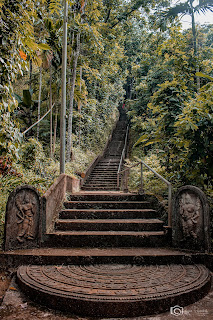
There is a rock with an unique shape which is reminiscent of a lizard spine next to the temple. You will find a stairway behind the temple to climb the rock.It is a narrow rocky strip of up to 500 m (maybe more).As the rock may be narrowed down to 4-5 ft at several places,You will have to be very careful while walking on the rock.
Degalathiriya katusu konda like rock aerial view
You can use Google Earth to get an idea of how the rock is spread out in the area.From the breathtaking view on the top of the rock you can see a large number of mountains such as Urakanda ,Batalegala(Bible Rock), Samasara mountain range, Kukulpitiyegala & Balalgala.As you continue to walk along the narrow cliff, you will find a cave-like place at the end .
A selfie from katusukonda
From the middle of the rock, you can go down to a pond located on another layer of rock.Make sure be careful when moving down along the rock.The pond, which is several meters long, is said to have never dried up.
If you will come to visit this place one day after the end of the COVID epidemic, kindly request you to as a responsible tourist or pilgrim,not to behave in a way that is not disrespectful or destructive .
You can watch the full video of the trip on Balloon House YouTube Channel via this link .
 බිරින්දෑ සමඟ මීමුරේ සංචාරය